Colorado fire map & tracker
Having easy access to a Colorado fire map is a convenient way to stay up-to-date on current conditions, fire risks, and active fires in the state.


Where are the fires in Colorado?
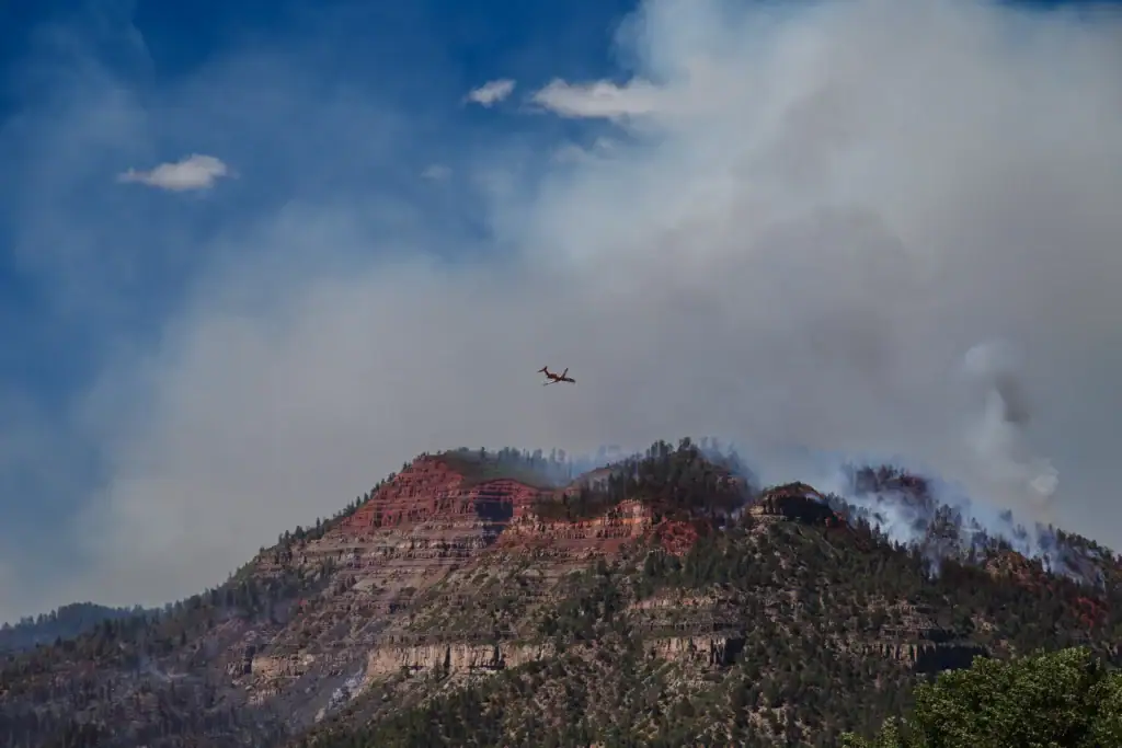
Wildfires are unpredictable. They can quickly change direction, surge ahead, and grow in intensity. You can keep tabs on nearby fires with the Frontline Wildfire Defense fire map of Colorado.
The fire map is updated daily to show active fires, known spread and boundaries, and recent activity. You can zoom in on an area, run a location search, and track individual fires.
Staying informed will help you plan ahead for fire season and make decisions if you, your family, and property face the threat of a wildfire.
Track fires in Colorado with the interactive fire map or the free Frontline Wildfire Defense App (Android | iOS).
Take Steps Before the Next Fire
If you’re looking for a faster, safer, more comprehensive way to protect your home during the Colorado fire season and throughout the year, we invite you to explore the Frontline Wildfire Sprinkler System and get a quote for your property.
Protect your home today.
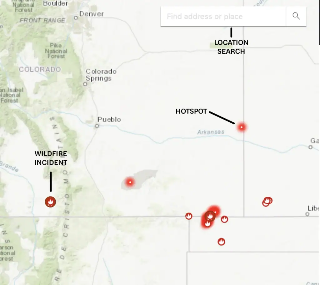
How to read the Colorado wildfire map
Use the search bar to type in your location, or zoom and scroll to explore the Colorado wildfire map. Map icons cover:
- Wildfire incident updates: Active Colorado fire incidents are displayed with a fire icon and the name of the fire. Click on an incident for the timestamp of its most recent update.
- Perimeters: Fire perimeters are displayed on the map with a light red overlay and bold red outline. This is not a live map. While it’s updated regularly, wildfires can spread rapidly. Do not rely on this tracker for real-time coverage.
- Hotspots: Thermal hotspots are shown as bright red dots. These hotspots could be the beginnings of wildfires, or they may be false positives that the satellite picked up due to other incidents, such as volcanic activity or oil and natural gas wells.
In addition to tracking fires in Colorado, you can use this map to track wildfire activity nationwide.
Track Colorado fires near you
Make faster, more informed decisions when a fire threatens. Track Colorado fires and get relevant information and updates all in one place.
Our Colorado wildfire tracker includes:
- Current fires
- Fire perimeter
- Evacuation warnings and orders
- Evacuation planning
- Smoke advisories
- Wind advisories
- Shelter locations


Getting help during Colorado forest fires
When there are active wildfires in Colorado, you need access to reliable and timely information. Keep these resources handy for the latest official alerts and updates, along with guidance about planning, getting help, and evacuating.
- Colorado Division of Fire Prevention and Control
- Colorado Division of Homeland Security & Emergency Management
- InciWeb
- FEMA wildfire assistance
Note: If you need help during an active wildfire or any other emergency, call 911 immediately.
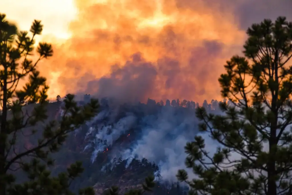
When is wildfire season in Colorado?
The Colorado wildfire season varies year to year. The largest fires have occurred between May and September. Dry weather and high temperatures increase fire risks.
The Front Range tends to dry out earlier in the year, supporting fast-moving fires. In late summer, higher elevations experience high heat and low humidity, increasing the amount of fuel for intense fires.
Colorado’s monsoon season typically starts in late July. When it’s strong, soaking rains lower fire risks. In years when the monsoon season is weak and rain is scattered, lightning in dry storms increases fire risks.
Preparing for Colorado wildfire season
You can take practical steps to protect your family and pets and reduce the risk of property damage. Having a clear strategy in place helps you make smart decisions under pressure.
Take effective action when it matters most by tracking current conditions and changes. In addition to the Colorado fire map, check these resources for the latest updates on weather, air quality, and wildfires.
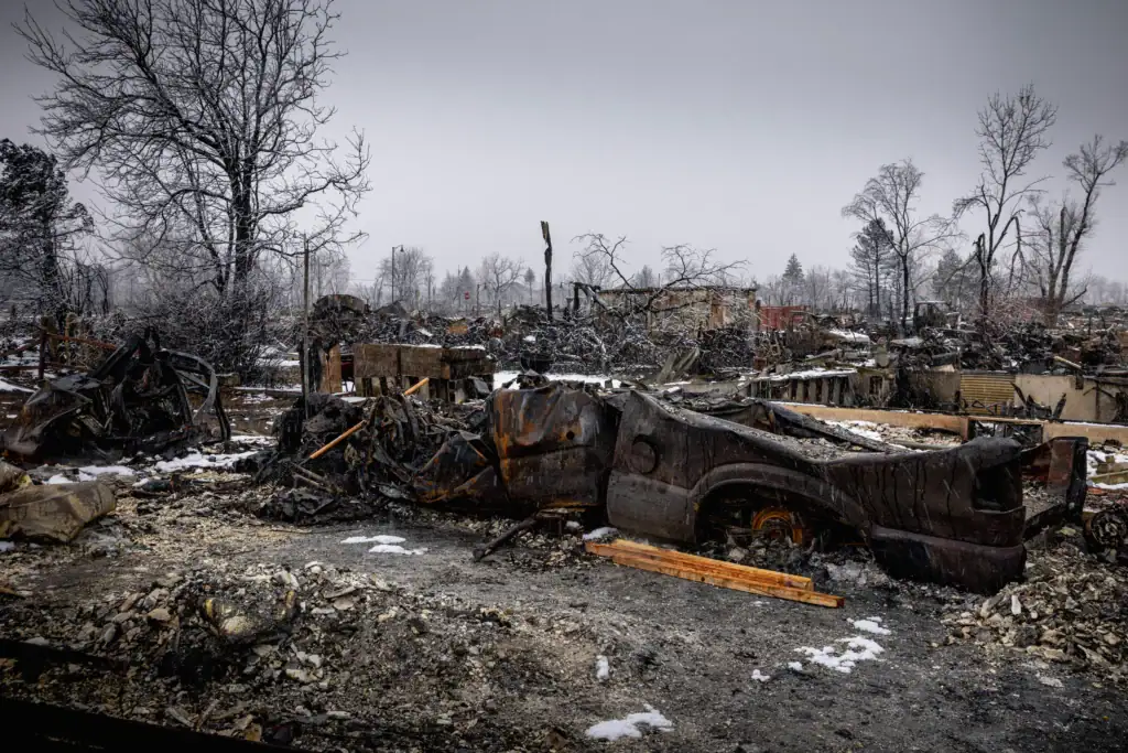
Recovery after Colorado fires
Navigating the aftermath of a fire can be emotionally and financially draining. From figuring out your first steps through rebuilding and recovery, these resources can help.
Colorado wildfire statistics
The number of Colorado fires varies year to year, depending on conditions. When it’s hot, dry, and windy, big fires can spark and spread quickly. Some recent examples include the Lee Fire of 2025, which roared through 130,000 acres, and the East Troublesome Fire that started in 2020 and grew to be one of the largest in state history.
Here’s an overview of Colorado wildfire statistics from the past decade:
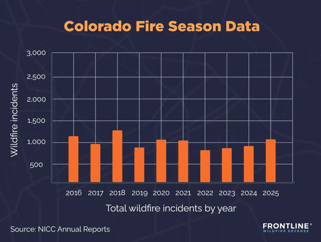
- 2020: 1,080 total wildfire incidents, 625,357 acres burned
- 2019: 857 total wildfire incidents, 40,392 acres burned
- 2018: 1,328 total wildfire incidents, 475,803 acres burned
- 2017: 967 total wildfire incidents, 111,667 acres burned
- 2016: 1,190 total wildfire incidents, 129,495 acres burned
- 2025: 1,123 total wildfire incidents, 255,968 acres burned
- 2024: 894 total wildfire incidents, 60,539 acres burned
- 2023: 861 total wildfire incidents, 41,917 acres burned
- 2022: 835 total wildfire incidents, 45,732 acres burned
- 2021: 1,017 total wildfire incidents, 48,195 acres burned
Source: NICC Annual Reports
What causes wildfires in Colorado?
Colorado wildfires have many causes. In hot, dry conditions, a small spark can turn into a serious threat. Several environmental characteristics, such as high winds, drought conditions, and dense forests, make fighting fires and protecting property especially difficult in the state.
Some of the factors leading to more destructive Colorado fires include:
- Lightning: This is the most common natural cause of wildfires in Colorado. It’s worse during the rainless thunderstorms that are common in late summer.
- Human actions: Whether unintentional or on purpose, people cause a large number of fires. Unattended campfires, smoldering cigarettes, power line failure, and malfunctioning equipment can spark a wildfire.
- Dry conditions: Days without rain and extended drought periods dry out grasses, shrubs, and trees, making them highly flammable. It just takes a spark for them to ignite.
- High winds: Windy conditions speed the drying of vegetation. And should a fire start, winds can spread embers over long distances.
- Wildland-urban interface growth: As people build further and further into Colorado’s mountains, forests, and open areas, structures become more vulnerable to wildfires.
- Steep terrain: While the Rocky Mountains attract skiers, hikers, and nature lovers, the landscape is difficult for firefighters to access when a wildfire starts.
FAQs
When was the largest wildfire in Colorado’s history?
In 2020, the Cameron Peak Fire burned across more than 208,000 acres in northern Colorado, becoming the largest in the state’s history. An extended drought dried vegetation to create fuel, and strong winds spread the blaze through challenging terrain. The dense forest, narrow canyons, and steep mountains in this remote area made it hard for firefighters to contain the fire.
Is Colorado at risk for wildfires?
Yes, wildfires are a natural part of ecosystems across Colorado. Climate change means many parts of the state face elevated fire risk each year. Dry grasses on the Eastern Plains, expanding development in the wildland-urban interface, and dense forests in mountain regions all contribute to wildfire risk, particularly during dry months.
What areas of Colorado are at high fire risk?
While the entire state experiences wildfires, the areas with greatest risk are in the densely forested mountains and the foothills that regularly see dry conditions and high winds. Counties that make up the Western Slope and the Front Range are the most vulnerable. Continued development in the wildland-urban interface has placed more people and structures in fire-prone areas.
How are wildfires affecting insurance coverage in Colorado?
Insurance coverage is becoming more expensive and more difficult to get in Colorado. Development is extending into high-risk areas around the ski areas in the mountains and along the Front Range from Fort Collins, past Denver, and on to Colorado Springs. Insurance companies are responding with higher premiums, tighter underwriting standards, and fewer options.
To help homeowners who can’t get coverage on the commercial market, the state created the Colorado FAIR Plan. As an insurer of last resort, it may be the only option for property owners in high-risk areas.
Get ahead of the flames. Make the Frontline Defense System your wildfire plan.
Be ready before the Colorado wildfire season starts. Frontline engineers intelligent wildfire defense systems that detect risk, automate response, and help protect properties before and during wildfire events. Once active, the system soaks your property with water and biodegradable firefighting foam, creating a protective barrier that stops embers before they ignite. Discover a smarter approach to wildfire protection and preparedness.
Track Colorado fires in any county
Whether you live in a Front Range community like Boulder, Fort Collins, or Colorado Springs or are in one of the mountain communities in the Rockies, the Frontline Colorado fire map helps you stay alert to fire activity in all 64 counties in the state, including:
- Adams County
- Archuleta County
- Boulder County
- Broomfield County
- Clear Creek County
- Douglas County
- Eagle County
- El Paso County
- Garfield County
- Gilpin County
- Grand County
- Huerfano County
- Jefferson County
- Larimer County
- Las Animas County
- Mesa County
- Park County
- Routt County
- Summit County
- Weld County
About the Colorado Wildfire Tracker and Map
The Colorado wildfire map on this page displays the best-known locations and perimeters of active fires in Colorado. Keep in mind that while elements in the wildfire map are updated daily, it should not be treated as a live wildfire map and is not intended to display evacuation routes.