Oregon fire map & tracker
Wildfires regularly threaten homes across Oregon, whether in mountain communities or high desert areas. Our Oregon fire map and tracker helps you keep up-to-date on active fires, prepare for fire risks, and stay safe with alerts and updates.





Where are the fires in Oregon?
Wildfires can occur across Oregon’s varied landscapes, including the forested Cascade Range, dry grasslands, and high desert regions in the east. These areas are especially vulnerable during hot, windy, and dry periods.
Wildfires can spread quickly in the right conditions. An Oregon fire map provides daily updates on the size, changing perimeters, and containment status of active fires. Zoom in on details and focus on hotspots near you or your loved ones. Accurate, up-to-date information helps you plan and make informed decisions.
Track fires in Oregon with the interactive fire map or the free Frontline Wildfire Defense App (Android | iOS).
Take Steps Before the Next Fire
If you’re looking for a faster, safer, more comprehensive way to protect your home during the Oregon fire season and throughout the year, explore the Frontline Wildfire Sprinkler System and get a quote for your property.
Protect your home today.
How to read the Oregon wildfire map
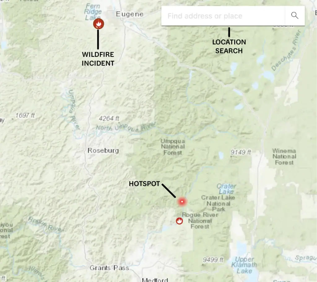
Use the search bar to type in your location, or zoom and scroll to explore the Oregon wildfire map. Map icons cover:
- Wildfire incident updates: Active Oregon fire incidents are displayed with a fire icon and the name of the fire. Click on an incident for the timestamp of its most recent update.
- Perimeters: Fire perimeters are displayed on the map with a light red overlay and bold red outline. This is not a live map. While it’s updated regularly, wildfires can spread rapidly. Do not rely on this tracker for real-time coverage.
- Hotspots: Thermal hotspots are shown as bright red dots. These hotspots could be the beginnings of wildfires, or they may be false positives that the satellite picked up due to other incidents, such as volcanic activity or oil and natural gas wells.
In addition to tracking fires in Oregon, you can use this map to track wildfire activity nationwide.
Track Oregon fires near you
An Oregon wildfire map and tracker combines live fire data, evacuation information, and weather alerts to help you monitor fast-changing conditions.
Our Oregon wildfire tracker includes:
- Current fires
- Fire perimeter
- Evacuation warnings and orders
- Evacuation planning
- Smoke advisories
- Wind advisories
- Shelter locations



Getting help during Oregon forest fires
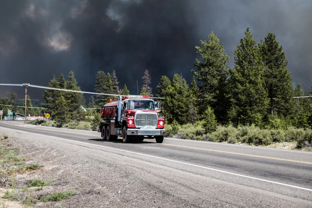
Oregon fires can spread rapidly and shift quickly as conditions change. These Oregon-specific resources can help you prepare, respond, and recover:
- Oregon Wildfire Response & Recovery – Prepare for Wildfires
- Oregon Wildfire Response & Recovery – Evacuations
- Oregon Department of Forestry – Fire Information
- Oregon Health Authority – Wildfires and Smoke
- Oregon State Fire Marshal – Wildfire in Oregon
Note: If you need help during an active wildfire or any other emergency, call 911 immediately.
When is wildfire season in Oregon?
Oregon’s wildfire season starts in late spring and lasts into early fall. July and September are peak fire risk months, and weather plays a major role in shaping the season. Risks vary from year to year, depending on winter snowpack, rainfall, temperatures, and wind patterns.
Forested areas in the Cascade Range and the rangelands to the east become increasingly dry during summer months. High temperatures and periods of drought can lead to bigger and more intense fires.
While summer and fall see the greatest number of wildfires, they can spark at any time of the year. Stay alert and informed with an Oregon wildfire map.
Preparing for Oregon wildfire season
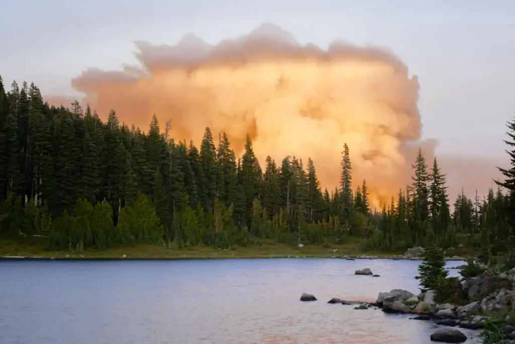
It’s important to take steps to harden your home while also planning ahead for a potential evacuation. These resources can help you face Oregon wildfires with confidence and resilience:
Oregon wildfires are unpredictable. Stay informed about active fires and smoke that can threaten your well-being:
Recovery after Oregon fires
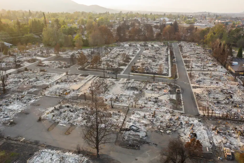
Rebuilding your home and getting your life back to normal following a wildfire is a process. These resources can help you as you navigate the aftermath of an Oregon forest fire:
Oregon wildfire statistics
Oregon residents have experienced a number of major wildfires in the last 10 years. The Labor Day fires in 2020 destroyed several communities. The Bootleg Fire was the second largest wildfire of the United States’ 2021 wildfire season and the third largest in state history.
A decade of data shows the variability in the number and severity of Oregon wildfires.
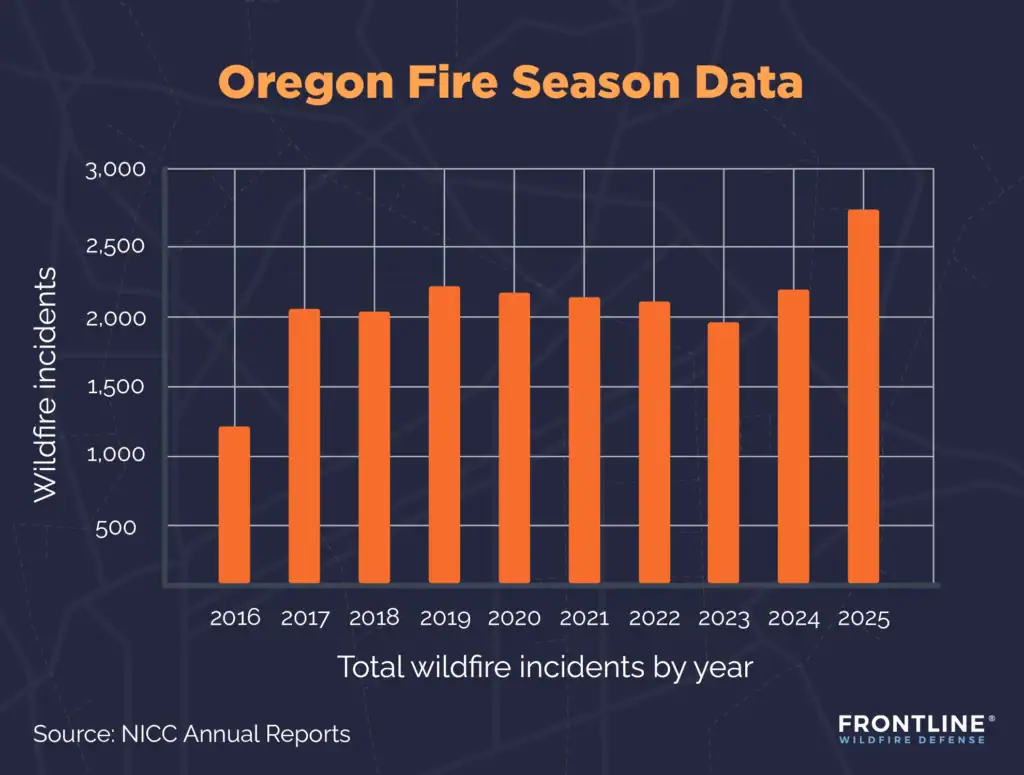
- 2025: 2,746 total wildfire incidents, 324,601 acres burned
- 2024: 2,232 total wildfire incidents, 1,797,796 acres burned
- 2023: 1,979 total wildfire incidents, 202,035 acres burned
- 2022: 2,117 total wildfire incidents, 456,082 acres burned
- 2021: 2,202 total wildfire incidents, 828,777 acres burned
- 2020: 2,215 total wildfire incidents, 1,141,612 acres burned
- 2019: 2,293 total wildfire incidents, 79,732 acres burned
- 2018: 2,019 total wildfire incidents, 897,262 acres burned
- 2017: 2,049 total wildfire incidents, 714,520 acres burned
- 2016: 1,245 total wildfire incidents, 219,509 acres burned
Source: NICC Annual Reports
What causes Oregon wildfires?
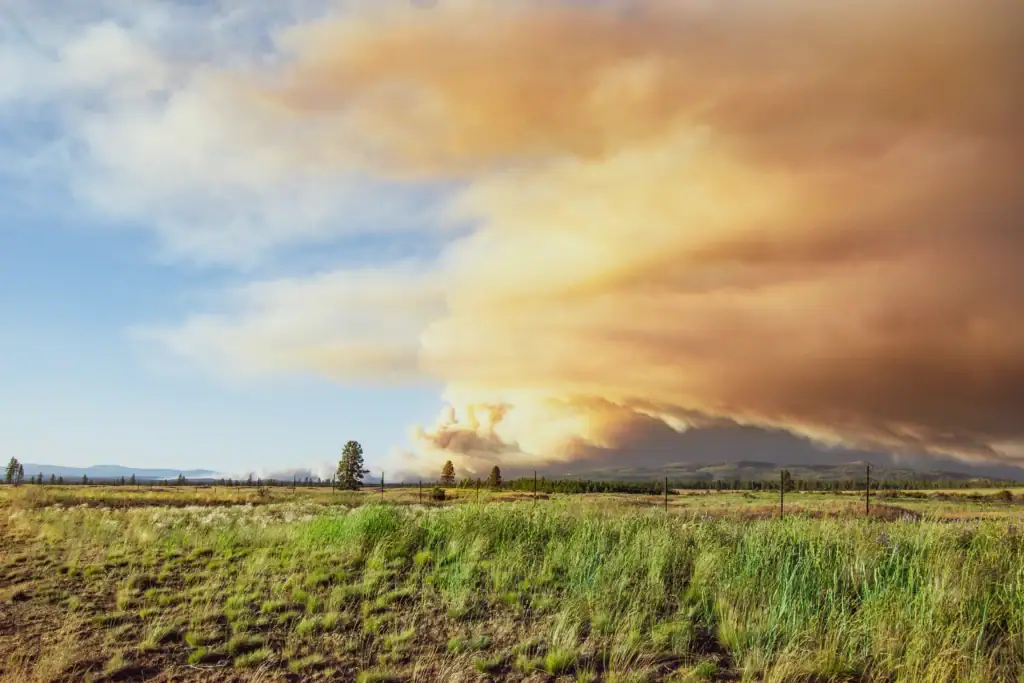
Both natural and human causes are known to spark Oregon fires. Additional factors then fuel and spread wildfires. Some of the main risk drivers include:
- Human causes: Human activity causes most Oregon wildfires. Malfunctioning equipment, downed power lines, unattended campfires, and vehicles are major ignition sources.
- Lightning: While not the largest cause of wildfires, fires started by lightning account for a significant share of acres burned. These fires tend to ignite in remote areas, making them harder to contain quickly.
- Heat and drought: Extended dry periods combined with high heat dries out grasses, brush, and trees, creating a fuel source for fires. As climate change leads to hotter and drier conditions, fire risks are growing.
- Wind: During Oregon summers, strong, dry winds contribute to wildfire intensity and propel embers ahead of the main fire, helping it spread faster and farther.
- Dense forests: Oregon’s climate, particularly in the Cascades, supports tree growth. Years of brush growth and accumulated dead vegetation from decades of fire control have created a high fuel load in many areas.
- Increased development: More homes and businesses are being built at the edge of suburbs and deep into rural areas. Buildings in the wildland-urban interface are at a higher risk for wildfires.
FAQs
When was the largest wildfire in Oregon’s history?
The largest Oregon fire was the Biscuit Fire of 2002. It started by lightning in the Siskiyou Mountains and burned 500,000 acres over several months. Extreme weather conditions and rugged, remote terrain made containment especially difficult.
Is Oregon at risk for wildfires?
Wildfires have always been a natural part of Oregon’s ecosystem, particularly in the hot, dry, and windy summer and early fall months. Recent fires show how quickly flames can escalate and spread. As development moves into higher-risk areas, threats to people and property are on the rise.
What areas of Oregon are at high fire risk?
Structures in rural areas and within the wildland-urban interface face the highest exposure to wildfire in Oregon. Elevated risk is most common in southern Oregon, east of the Cascade Range, and in forested mountainous regions where dry vegetation and terrain lead to fast-moving fires. Using an Oregon fire map helps you stay informed about active fires and changing conditions in your area.
How are wildfires affecting insurance coverage in Oregon?
Growing fire exposure is affecting Oregon’s insurance markets. If you own property in higher-risk areas, you may see increased premiums, stricter underwriting standards, fewer coverage options, and challenges obtaining any kind of coverage. Oregon’s FAIR Plan is an alternative to commercial insurance, providing basic coverage for property owners who don’t qualify for market plans. Improve your insurability and your property’s resilience by creating a defensible space around your home, hardening it against embers, and taking other wildfire protection steps.

Get ahead of the flames. Make the Frontline Defense System your wildfire plan.
Be ready before the Oregon wildfire season starts. Frontline engineers intelligent wildfire defense systems that detect risk, automate response, and help protect properties before and during wildfire events. Once active, the system soaks your property with water and biodegradable firefighting foam, creating a protective barrier that stops embers before they ignite. Discover a smarter approach to wildfire protection and preparedness.
Track Oregon fires in any county
The Frontline Oregon fire map keeps you up-to-date on fire conditions, active wildfires, smoke and weather, evacuations, and emergency alerts in all 36 counties in Oregon. From Medford to Bend and along the Willamette Valley, you can track current, location-specific conditions.
- Benton County
- Clackamas County
- Clatsop County
- Columbia County
- Coos County
- Deschutes County
- Douglas County
- Jackson County
- Josephine County
- Klamath County
- Lane County
- Lincoln County
- Linn County
- Marion County
- Multnomah County
- Polk County
- Umatilla County
- Washington County
- Yamhill County
About the Oregon Wildfire Tracker and Map
The Oregon wildfire map on this page displays the best-known locations and perimeters of active fires in Oregon. Keep in mind that while elements in the wildfire map are updated daily, it should not be treated as a live wildfire map and is not intended to display evacuation routes.