Montana fire map & tracker
Stay ahead of Montana fires with our Montana fire map and tracker app. You’ll get key updates on wildfires across the state so you can make informed decisions and stay safe.


Where are the fires in Montana today?
If you want to know where fires in Montana are burning today, and access important information right on your phone, use our wildfire map and app.
Wildfires are unpredictable. Keep tabs on changing conditions about current fires in Montana and when new ones spark. You can track location, size, and containment status so you know exactly what’s happening and can assess the risks to you, your family, and your property.
From the mountains and forested valleys of the western part of the state to the central plains and eastern prairies, the Montana wildfire map makes it easy to stay aware and informed.
Track Montana wildfires today with the interactive fire map or download the free Frontline Wildfire Defense App (Android | iOS).
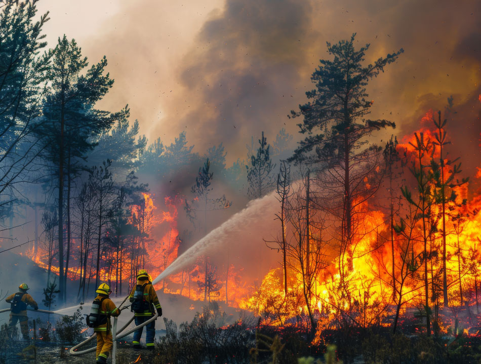
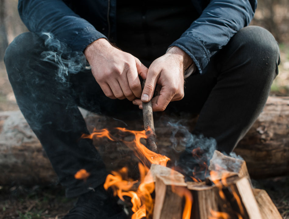
Take Steps Before the Next Fire
If you’re looking for a faster, safer, more precise way to protect your home during the Montana fire season, or any time during the year, we invite you to explore the Frontline Wildfire Defense System and get a quote for your property.
Protect your home today.
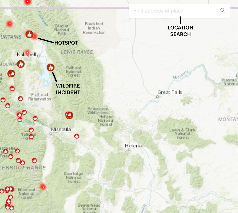
How to read the Montana wildfire map
Use the search bar to type in your location, or zoom and scroll to explore the Montana wildfire map. Map icons cover:
- Wildfire incident updates: Active Montana fire incidents are displayed with a fire icon and the name of the fire. Click on an incident for the timestamp of its most recent update.
- Perimeters: Fire perimeters are displayed on the map with a light red overlay and bold red outline. This is not a live map. While it’s updated regularly, wildfires can spread rapidly. Do not rely on this tracker for precise coverage.
- Hotspots: Thermal hotspots are shown as bright red dots. These hotspots could be the beginnings of wildfires, or they may be false positives that the satellite picked up due to other incidents, like volcanic activity, oil and natural gas wells, etc.
In addition to tracking fires in Western Montana and Eastern Montana, this map can be used to track wildfire activity nationwide.
Track Montana fires near you
Having accurate, timely information allows you to make better decisions about your family’s safety in the face of a Montana wildfire.
The interactive fire map of Montana is just the beginning. The app puts everything you need to know in your hands.
Our Montana wildfire tracker includes:
- Current fires
- Fire perimeter
- Evacuation warnings and orders
- Evacuation planning
- Smoke advisories
- Wind advisories
- Shelter locations


Get help during Montana forest fires
If you’re under threat of or are being affected by fires in Montana, trying to find assistance and the most recent information can be stressful.
Here are resources you can use to get help and stay informed:
- FEMA wildfire assistance
- National Interagency Fire Center (NIFC) wildfire information
- Montana fire information
Note: If you need help during an active wildfire or any other emergency, call 911 immediately.
When is wildfire season in Montana?
Montana wildfire season typically starts in May and runs through September. The warmer temperatures and low humidity during these months dry out trees, brush, and grasses. Strong summer storms and accompanying winds create the ideal conditions for fires to spark and spread.
The fire season in Montana has been shifting in recent years. Spring months are drier and hotter than they used to be, leading to earlier snowmelt. The drought dries vegetation earlier and stresses trees, leading to more standing deadwood and intense fires.
Efforts to prepare the state for a longer fire season are underway.
Preparing for Montana wildfire season
Being ready for the upcoming wildfire season in Montana is the surest way to stay safe and protect your property from forest fires.
The resources below can help you harden your property against a wildfire and prepare for potential evacuation:
It’s essential to stay informed during wildfires. In addition to having a live fire map on your phone, you’ll want to track Montana air quality, weather conditions, and other risk factors.
Here are additional resources for staying in the know:

Recovery after Montana fires
Returning after a Montana fire can be emotionally and financially tough. Having the right information for the next steps and access to resources can help you with rebuilding your property and your life:
Montana wildfire statistics
Montana wildfire statistics vary year to year, with the number of acres burned ranging from 65,000 to 350,000.
So far, the 2025 Montana wildfire season includes the McAllister Fire, which burned over 3,560 acres, and the Windy Rock Fire, which burned over 6,040 acres. The Windy Rock Fire sparked on August 14, 2025, and was only 68% contained by the end of September.
Here are the annual Montana fire statistics for the last ten years:
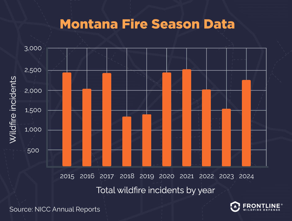
- 2024: 2,323 total wildfire incidents, 352,491 acres burned
- 2023: 1,662 total wildfire incidents, 123,133 acres burned
- 2022: 2,087 total wildfire incidents, 137,509 acres burned
- 2021: 2,573 total wildfire incidents, 747,678 acres burned
- 2020: 2,433 total wildfire incidents, 369,633 acres burned
- 2019: 1,474 total wildfire incidents, 64,835 acres burned
- 2018: 1,342 total wildfire incidents, 97,814 acres burned
- 2017: 2,422 total wildfire incidents, 1,366,498 acres burned
- 2016: 2,026 total wildfire incidents, 114,594 acres burned
- 2015: 2,432 total wildfire incidents, 351,264 acres burned
Source: NICC Annual Reports
What causes wildfires in Montana?
People are responsible for most Montana forest fires. Tossed cigarettes, unattended campfires, sparking machinery, and electrical infrastructure are often to blame. As more people settle in Montana, the risks grow.
Various weather and ecological causes create ideal conditions for Montana fires. You can see a pattern in the Montana fire map. The environmental factors that contribute to the start and spread of Montana wildfires include:
- Lightning: The initial spark of wildfires in remote areas usually comes from lightning associated with weather systems crossing the state. When a bolt strikes a dead tree or grass-covered field, it can start a fire that quickly spreads.
- High fuel loads: The dense forests and open prairies in Montana make it easy for fires to start and spread. Dead trees and overgrowth burn with intensity.
- Strong winds: Storms that bring lightning also bring high winds that fan the flames and spread the wildfire.
- Drought: Longer periods without rain dry out soils and vegetation. Trees weakened by drought are prone to disease, leaving dead standing timber that feeds fires.
FAQs
When was the largest wildfire in Montana state history?
The Great Fire of 1910 is the largest fire catastrophe to hit Montana. Also called the Big Burn, it began on August 20, 1910, and raged over 3 million acres across Montana, Washington, and Idaho within 48 hours. Among fires in western Montana, it was by far the largest and most destructive, with 87 people losing their lives.
Are wildfires in Montana more common now?
Yes, fires in Montana are becoming more common and more intense. While your concern may be fires in Montana right now, thinking about future trends is essential.
Montana wildfires are a natural part of the ecosystem and our history. But climate change is reducing rainfall and snow, as well as increasing average temperatures. This intensifies fire risks in the state. A longer fire season and larger, less controllable fires are becoming more common.
Which areas of Montana are most prone to wildfires?
The entire state of Montana is prone to wildfires, but the greatest danger to people and property is in areas designated as a wildland-urban interface. When development occurs at the edge of cities and suburbs, homes and businesses meet forests and grasslands. Expansion in these areas exposes people and buildings to higher wildfire hazards.
Are wildfires affecting the insurance industry in Montana?
Yes, the increase in wildfires is changing the insurance market in Montana. More frequent, larger, and more intense fires in Montana make it more expensive for insurance companies to cover residents and businesses.
It isn’t just the number of blazes on a fire map of Montana. The cost of fires in California and other states is being spread to all customers, including those here. Montana does not have a state-run FAIR Plan that offers basic coverage to people who cannot find insurance on the market.
If you’re struggling, take a look at insurance options for homeowners in high-risk areas. You may be able to find coverage from surplus line insurers or mutual insurance companies.

Get ahead of the flames. Make the Frontline Defense System your wildfire plan.
You can take proactive steps to protect your home. The Frontline Wildfire Defense exterior sprinkler system gives you automated, precise protection that’s fully connected so you can be confident in the face of Montana wildfires. Discover how proactive fire protection works and can give you lasting peace of mind.
Track Montana fires in any county
The interactive Montana fire map and tracker provides you with important information from the Bitterroot Valley to Missoula and points all around the state. Know exactly where fires are burning today, in any Montana county, including:
Beaverhead County
Big Horn County
Blaine County
Broadwater County
Carbon County
Carter County
Cascade County
Chouteau County
Custer County
Daniels County
Dawson County
Deer Lodge County
Fallon County
Fergus County
Flathead County
Gallatin County
Garfield County
Glacier County
Golden Valley County
Granite County
McCone County
Meagher County
Mineral County
Missoula County
Musselshell County
Park County
Petroleum County
Phillips County
Pondera County
Powder River County
Powell County
Prairie County
Ravalli County
Richland County
Roosevelt County
Rosebud County
Sanders County
Sheridan County
Silver Bow County
Stillwater County
About the Montana Wildfire Tracker and Map
The Montana wildfire map on this page displays the best-known locations and perimeters of active fires in Montana. While elements in the wildfire map are updated daily, it should not be treated as a live wildfire map and is not intended to display evacuation routes.