California fire map & tracker
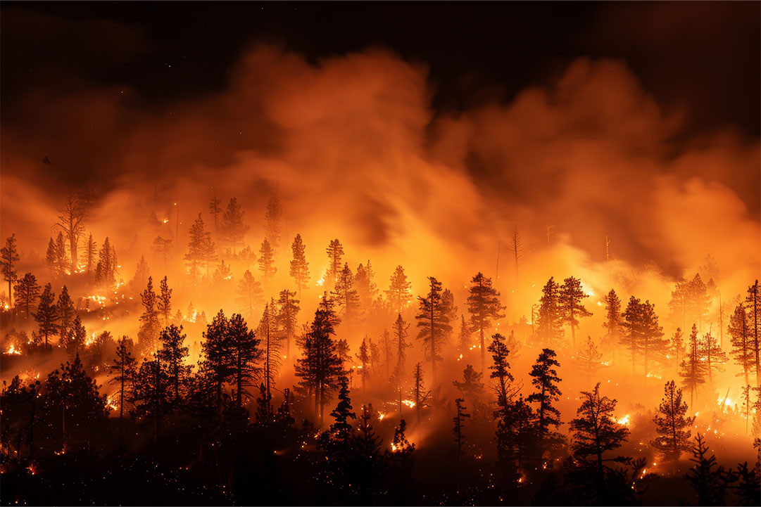
California fires are inevitable across the state. Wildfires are always possible in California, however, during the dry, hot months of spring, summer, and early fall, the risk is greatest. Use the following resources and alerts to help you stay safe.


Are the California fires still burning?
An unusually dry winter and high winds are upping wildfire risks. The Silver Fire near Bishop, west of San Francisco and close to Nevada, has led to evacuations from 800 homes. Areas affected by the California wildfires in Los Angeles County are slowly recovering. Although 16,251 homes and other structures were destroyed, only four building permits have been issued. Get current information with the interactive fire map or the free Frontline Wildfire Defense App (Android | iOS).
Take Steps Before the Next Fire
If you are looking for a faster, safer, more precise way to protect your home during the California fire season or any time during the year, we invite you to explore the Frontline Wildfire Sprinkler System and get a quote for your property.
Protect your home today!
How to read the California fires map
- Fire location search. Use the search bar to type in your location, or zoom and scroll to explore the CA wildfire map.
- Wildfire incident updates. Active fire incidents will be displayed with a fire icon and the name of the fire. Timestamps of the most recent updates can be viewed by clicking on an incident.
- Perimeters. Fire perimeters are displayed on the map with a light red overlay and bold red outline. Note that this is not a live map. While the map is updated regularly, wildfires can spread rapidly. Do not rely on this tracker for precise coverage.
- Hotspots. This map displays thermal hotspots, which are shown as bright red dots. These hotspots could be the beginnings of wildfires, or they may be false positives that the satellite picked up due to other incidents like volcanic activity, oil and natural gas wells, etc.
- National coverage. In addition to Northern California wildfire tracking and Southern California wildfire tracking, this map can be used to track wildfire activity nationwide.
Track California fires near you.
Know what California fires threaten your property based on your home address, The Frontline App shows you a “fires in California right now” map so you have pinpoint detail on fire threats. The app also sends proactive wildfire notifications, including new fire alerts, red flag warnings, fire weather watches, lightning events, wildfire evacuation notices, and more.
Our California wildfire tracker includes .
- Current CA fires
- CA fire perimeter
- CA evacuation warnings
- CA evacuation orders
- Evacuation planning
- Smoke advisories
- Wind advisories
- Shelter locations


Getting help during California wildfires
In addition to having a California wildfire map in your hand, you will want to be prepared to respond should your home be threatened. The links below will help you develop your response plan and give you links to key emergency resources:
- California Local Fire Districts (click on the map to locate phone numbers)
- FEMA Wildfire Assistance
- CAL FIRE Contacts
Remember, if you need help during an active wildfire or any other emergency, you should forego these resources and immediately call 911.
2025 California fire season updates and outlook
Wet weather leading up to January 2025 has encouraged rapid growth of vegetation that became tinder when the Santa Ana winds started blowing during the first week of January. It has been an early start to the fire season and a grim one. Since the start of the year, 610 wildfires have burned in the state, destroying almost 60,000 acres and 16,251 structures.
Fire risk remains high as we enter warmer months with unusually dry weather. The California wildfire tracker is a way to keep an eye on current California fire activity, customized to your home address, so you can take appropriate action to protect your property. It is free on the Frontline Wildfire Defense App (Android | iOS).
March 2025: New fire hazard maps released in California
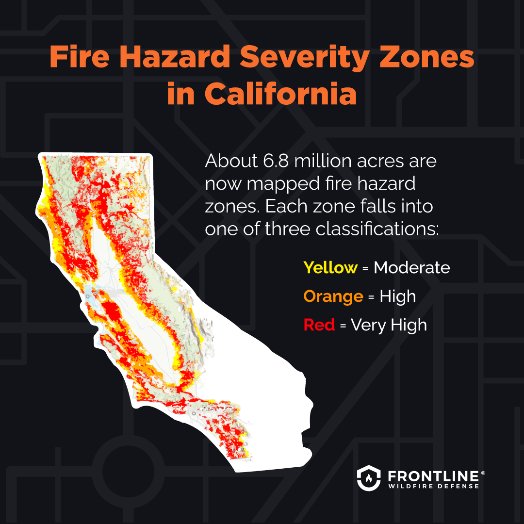
Following the California fires that ravaged the Los Angeles area, authorities have issued the first revised fire maps in 14 years. The maps identify Fire Hazard Severity Zones from moderate to high and very high. The designations take into consideration past fires, the amount of vegetation that can become fuel, the length of possible flames, the path of blowing embers, terrain features, and weather patterns. About 6.8 million acres are now fire hazard zones.
Preparing for California wildfire season.
Adequate preparation for a potential fire can make the difference between losing your home and saving it. The resources below detail how to put preventative measures into place and how to plan for the safety of your family.
Advance preparation and ongoing vigilance may save your property and your life. With lead time from an early warning, you can evacuate with critical belongings, begin mitigation efforts, and save yourself and your family from injury, health problems, or worse. Keep an eye on the severity of fires and the harmful effects of the smoke they produce through these resources:
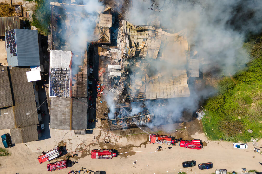
Recovery after California fires
If you have returned home after evacuating only to find the worst has happened, you will need to deal with the aftermath, from the practical next steps, to how to cope with the emotional impact of your loss, to how to deal with financial aspects. These resources can help guide you:
California wildfire statistics per year.
By studying the history of California wildfire activity and California fires map history, we see the trend of an extended California fire season. Wildfires are a possibility at any time of the year. Some of the state’s most recent and destructive wildfires have happened outside the normal California wildfire season, such as the Thomas Fire of December 2017. Many experts agree that a year-round fire season is a new norm. Find out the number of wildfires per year in California below.
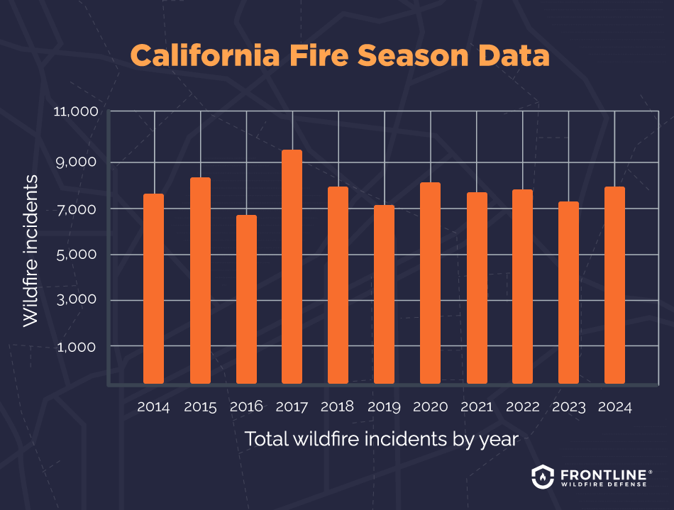
- March 2025: 578 total wildfire incidents, 58,108 acres burned.
- 2024: 8,024 total wildfire incidents, 1,050,012 acres burned.
- 2023: 7,127 total wildfire incidents, 324,917 acres burned.
- 2022: 7,477 total wildfire incidents, 331,358 acres burned.
- 2021: 7,396 total wildfire incidents, 2,569,386 acres burned.
- 2020: 8,648 total wildfire incidents, 4,304,379 acres burned.
- 2019: 7,148 total wildfire incidents, 277,285 acres burned.
- 2018: 7,948 total wildfire incidents, 1,975,086 acres burned.
- 2017: 9,270 total wildfire incidents, 1,548,429 acres burned.
- 2016: 6,954 total wildfire incidents, 669,534 acres burned.
- 2015: 8,283 total wildfire incidents, 880,899 acres burned.
- 2014: 7,233 total wildfire incidents, 625,540 acres burned.
Source: CAL FIRE
What causes wildfires in California?

The state’s unique climate is the main reason why California fires are inevitable. Here are the risk factors you need to know:
- Santa Ana winds. The winds that sweep down from the mountains and out over the Pacific can easily reach speeds of 40 miles per hour up to hurricane strength of 74 miles per hour, with gusts over 85 miles per hour. They can turn a small fire into a major conflagration, carrying embers extraordinary distances. When these winds strike during a dry period, the risks they bring are magnified.
- Rising temperatures. Rising temperatures are responsible for increased wildfire risks across the state of California. According to the Union of Concerned Scientists, average temperatures in the United States increased by two degrees since 1970. That means, according to the National Wildlife Federation, spring snow melts are occurring one to four weeks earlier than 50 years ago, resulting in forests that are drier longer for a longer fire season.
- Dry climate. Decreased rainfall in California creates prime conditions for wildfires. According to National Geographic, rising temperatures result in more water drawn from plants, soil, and vegetation. This landscape is a natural fuel source for wildfires, increasing the risk of fires tenfold. Under drought conditions, wildfires can spread rapidly.
FAQs
When is wildfire season in California?
It is a mistake to think that the California fire season is limited to the hot summer months. September and October are actually the most damaging months for California wildfires. That is when the Santa Ana winds are most common. While more fires may take place in July, a look at the historical California fire map shows that they typically result in less damage, considering acres burned. Autumn winds and dry vegetation make September and October fires more destructive
When was the biggest wildfire in California’s history?
The largest wildfire in California history was the August Complex fire. Several fires started in mid-August 2020 with lightning strikes and burned to merge together. The last embers were not extinguished until November.
When is fire season in Southern vs. Northern California?
In a state as large and varied as California, it makes sense that the California wildfire season differs from place to place.
- Southern California: The first significant rainfall is usually in November or December, making the fire season longer on average than Northern California.
- Northern California: The rainy season usually starts in October, giving the region a shorter wildfire season.
How are the wildfires affecting the insurance industry in California?
Homeowners in fire-prone areas are finding it tougher to find, keep, and pay for insurance coverage that includes protection from wildfires. That leaves them with two options:
- The California FAIR Plan is the insurer of last resort for both homeowners and renters. It is a cooperative effort of companies authorized to sell property insurance in California.
- Surplus lines carriers, such as Lloyd’s of London, which are much less regulated than mainstream carriers.

Get ahead of the flames. Make the Frontline Defense System your wildfire plan.
Preparation is vital. Insurance against wildfire damage is good if you can get it. Preventing wildfire losses may be the best option of all.
Track California wildfires in any county.
Maps to track fires in California today help you stay aware of your risks, whether you’re in the Bay Area, Los Angeles, or Malibu. With our free app, you can track wildfires near you anywhere in California, including the following counties:
Butte County
Humboldt County
Lake County
Orange County
Riverside County
About the California Wildfire Tracker and Map
The California wildfire map on this page displays the best-known locations and perimeters of active fires in California. Keep in mind that while elements in the wildfire map are updated daily, it should not be treated as a live wildfire map and is not intended to display evacuation routes.